Ground Penetrating Radar (GPR) Is Highly Effective In Detecting Density Differentials Between Both Structural And Natural Layers
Ollerhead & Associates Ltd. can provide GPR mechanics and evaluation for the following applications:
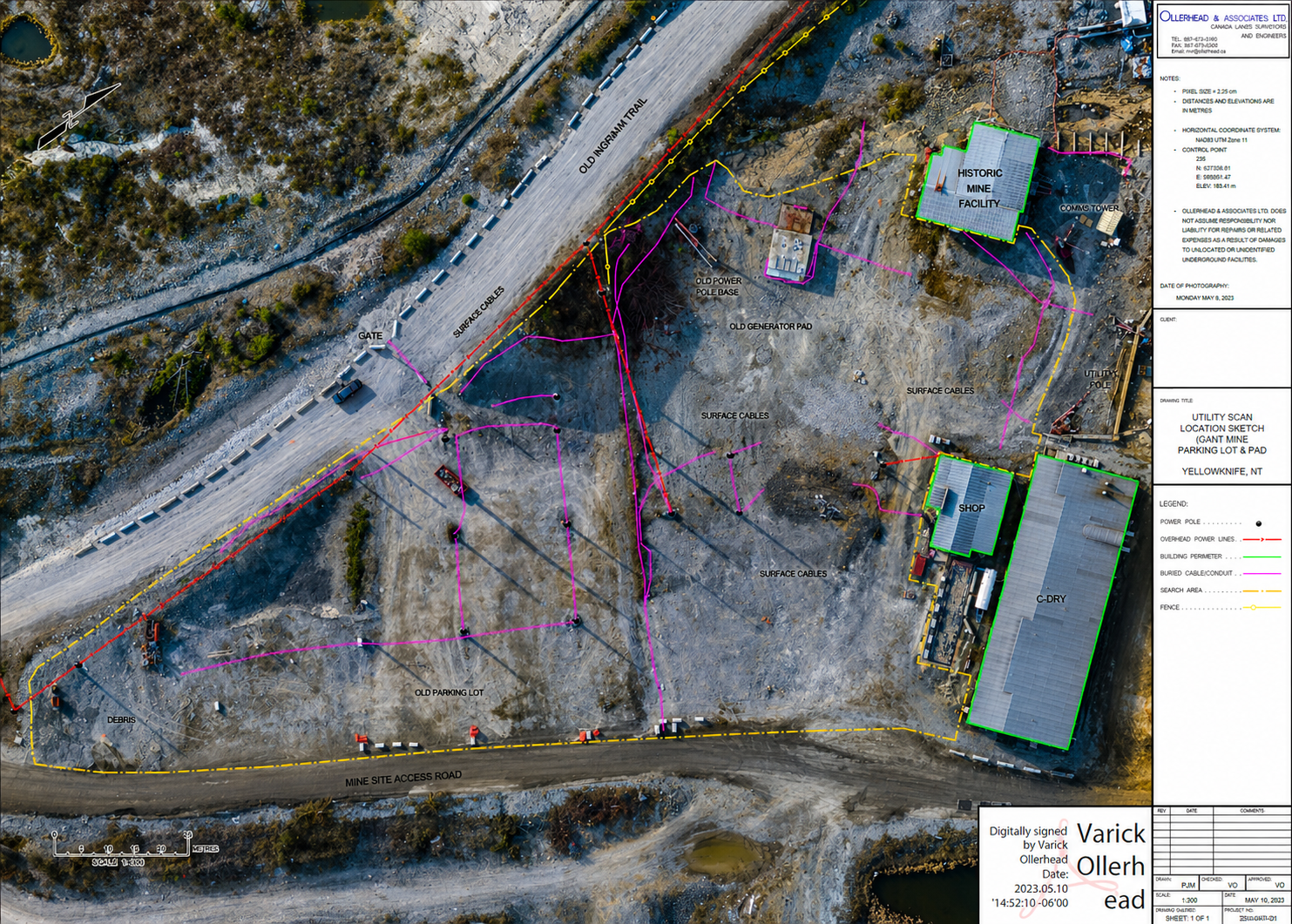
Subsurface Utility Location
Structure Assessment
Foundation Scanning
Location of Subsurface Voids
Bedrock and Soil Composition
Permafrost and Ice Lens Detection
Ice Thickness Profiling
Winter Season Bathymetry
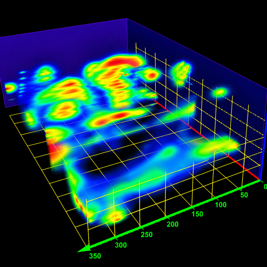
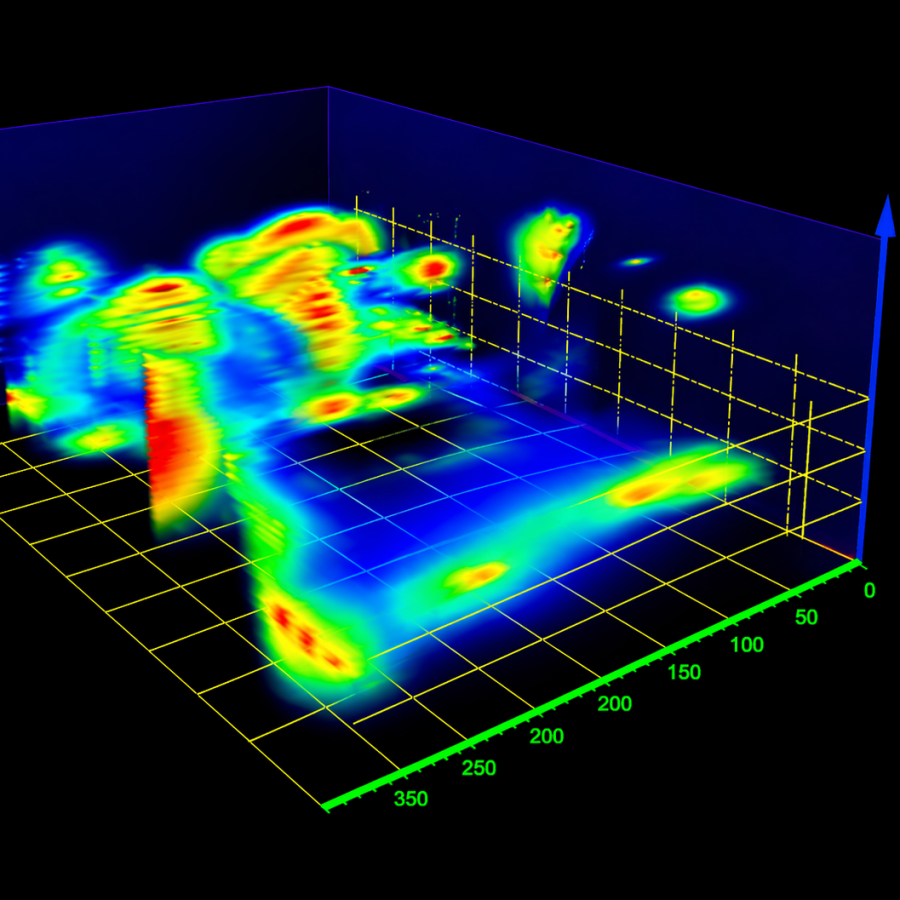
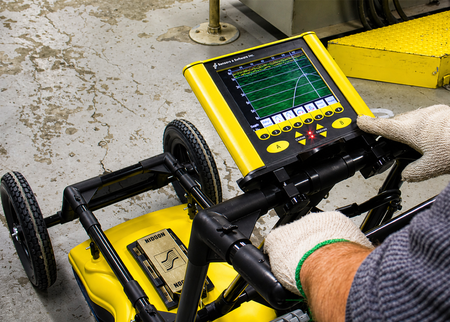
Ground Penetrating Radar (GPR)
By using GPR, Ollerhead & Associates Ltd. provides a method of non-destructive inspection of subsurface infrastructure.
A detailed 3D model of the size, location, and depth of an object or void is created for accurate mapping of underground entities.
LINE LOCATING
Our team is trained and certified in industry-standard methods for accurate underground utility detection and marking.