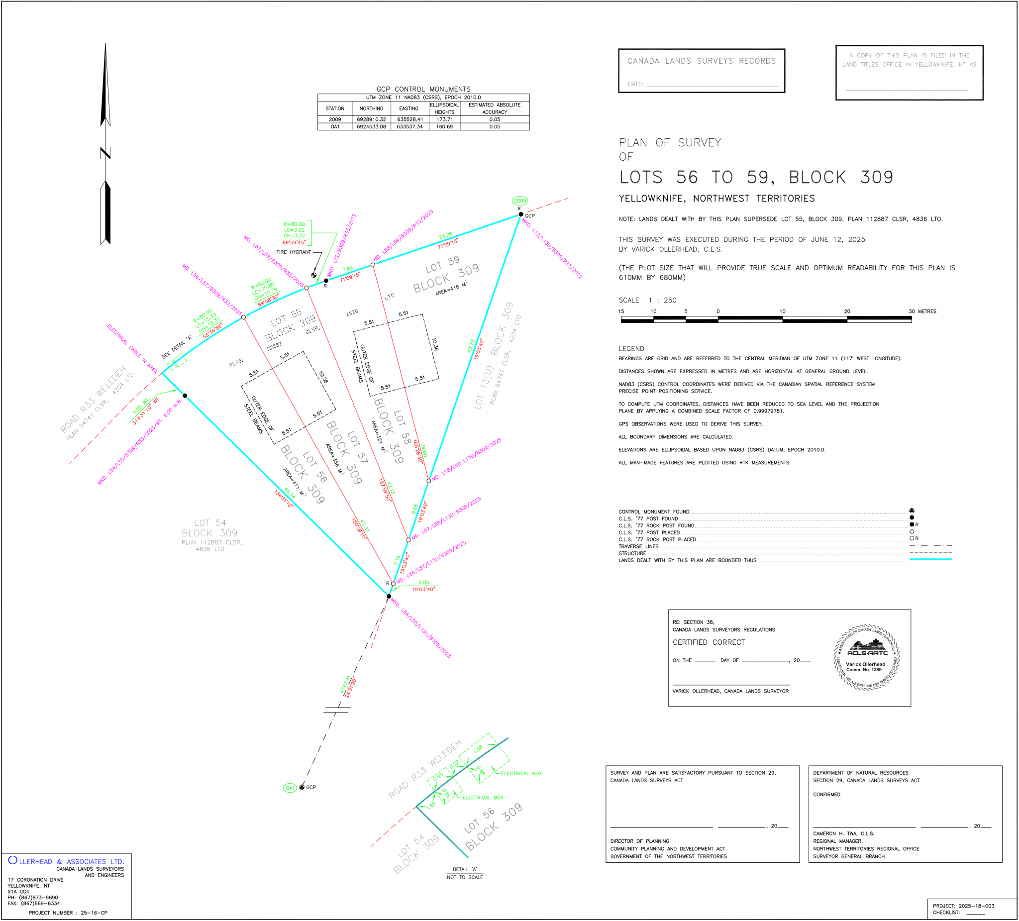
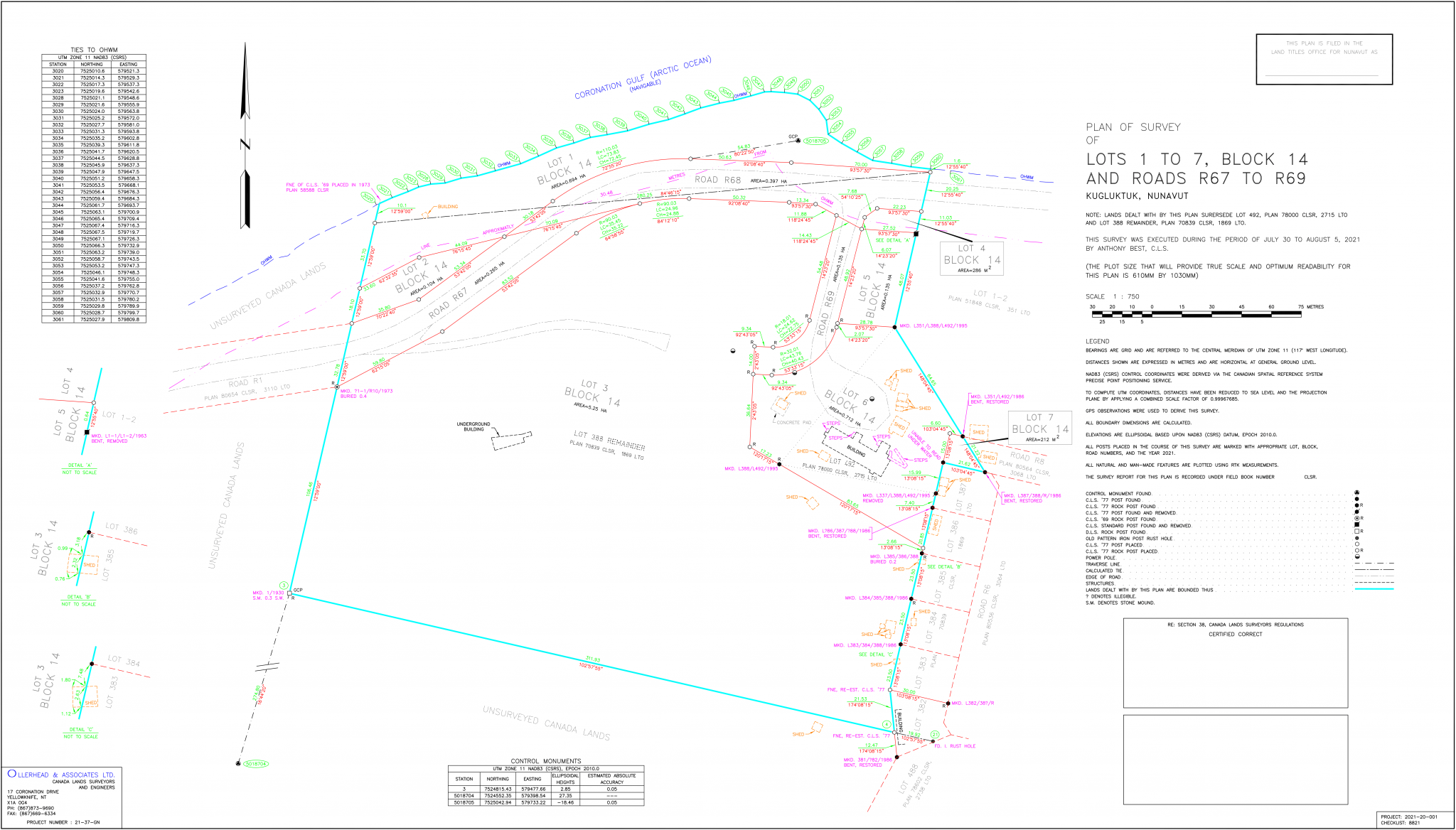
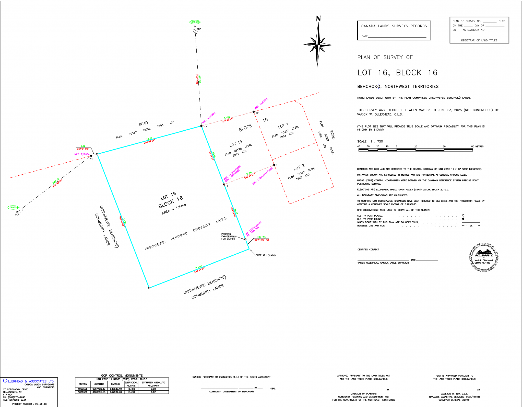


SCALE: ruler ratio that measures distances from the drawing to real world
CANADA LANDS SURVEY RECORDS: to assign a unique survey document identifier by the SGB
LAND TITLES OFFICE: to assign a unique parcel identifier on the registered land
ARROW: graphic symbol showing map orientation, indicating the north direction
CONTROL MONUMENT TABLE: are physical markers with known coordinates used by surveyors
TITLE: Identifies the type of survey, record, registration and property’s location
SURVEY DATE: effective date on which survey work is carried out and finalized
PAPER SIZE: set to a convenient length and width for printing
LEGEND: provides explanations of notes, symbols, lines, and colors to enhance visual clarity
CERTIFICATION: to be signed or sealed to attest the fulfillment of requirements
CERTIFICATION: to be signed or sealed to attest the fulfillment of requirements
CERTIFICATION: to be signed or sealed to attest the fulfillment of requirements
CERTIFICATION: to be signed or sealed to attest the fulfillment of requirements
COMPANY CONTACT INFO: Clients can reach Ollerhead by phone, fax and email
SURROUNDING LOTS: Adjacent lots that are immediately next to the property
SURROUNDING LOTS: Adjacent lots that are immediately next to the property
SURROUNDING LOTS: Adjacent lots that are immediately next to the property
SURVEYED LOT: land area where the Property Boundary Survey was conducted
PROPERTY BOUNDARY: defines the legal limit of the surveyed area
GROUND CONTROL POINTS: shows the location of the found Control Monuments and Stations
GROUND CONTROL POINTS: shows the location of the found Control Monuments and Stations
TIE LINES: measured lines from control point to lot’s corner to ensure survey accuracy
TIE LINES: measured lines from control point to lot’s corner to ensure survey accuracy
DIMENSION: measurement of the property line in meters
DIMENSION: measurement of the property line in meters
DIMENSION: measurement of the property line in meters
DIMENSION: measurement of the property line in meters
DIMENSION: measurement of the property line in meters
DIMENSION: measurement of the property line in meters
BEARING: measured direction of the property line
BEARING: measured direction of the property line
BEARING: measured direction of the property line
BEARING: measured direction of the property line
BEARING: measured direction of the property line
BEARING: measured direction of the property line
BEARING: measured direction of the lot line
BEARING: measured direction of the lot line
BEARING: measured direction of the tie line
BEARING: measured direction of the tie line
BEARING: measured direction of the lot line
DIMENSION: measurement of the lot line in meters
DIMENSION: measurement of the lot line in meters
DIMENSION: measurement of the tie line in meters
DIMENSION: measurement of the tie line in meters
DIMENSION: measurement of the lot line in meters