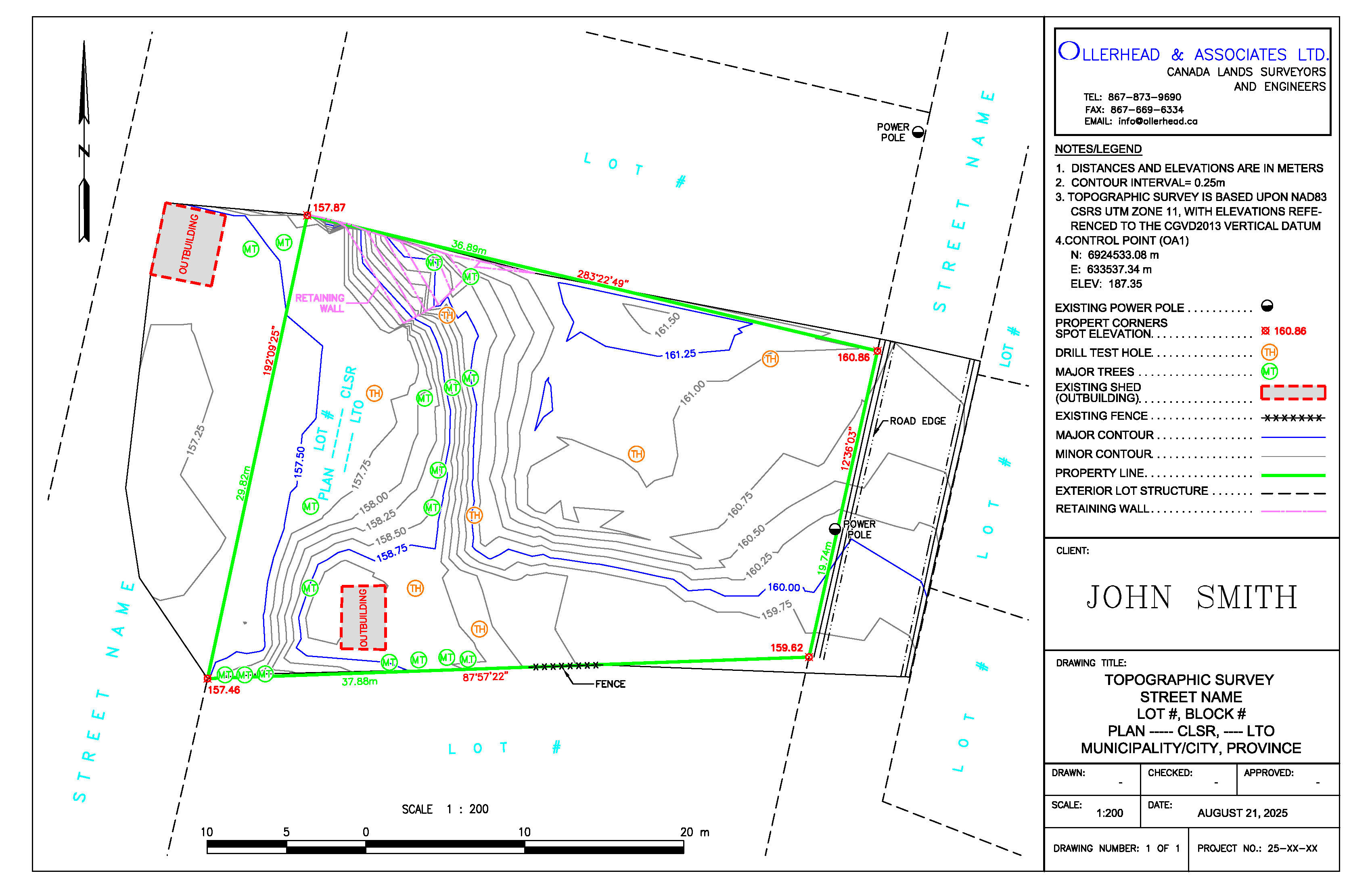
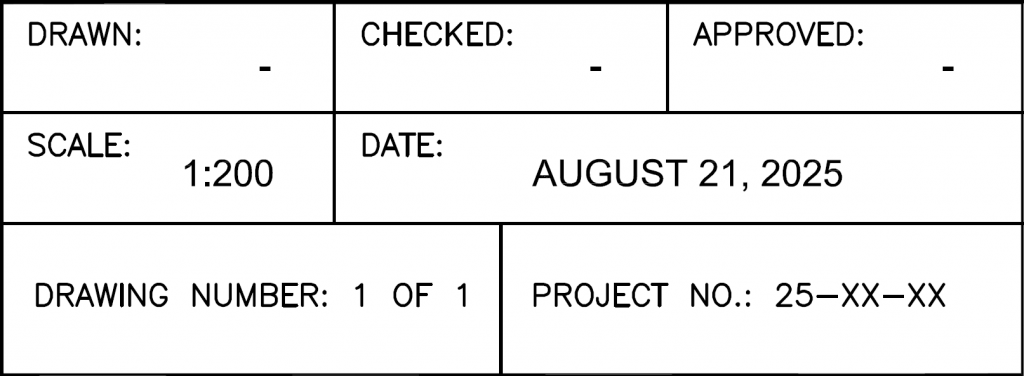
COMPANY CONTACT INFO: Clients can reach Ollerhead by phone, fax and email

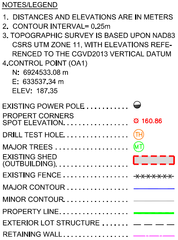
NOTES/LEGEND: Written explanations, references, and symbols to clarify the drawing
CLIENT: This section displays the company name or client’s logo

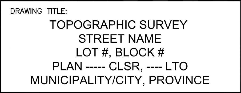
DRAWING TITLE: Contains survey types conducted, location, lot number, and plan number
This section includes information applicable to the drawing for clarity
NORTH ARROW: Graphical symbol showing map orientation, indicating the north direction
![]()
SURROUNDING LOT: Adjacent lots that are immediately next to the property

SURROUNDING LOT: Adjacent lots that are immediately next to the property
SURROUNDING LOT: Adjacent lots that are immediately next to the property
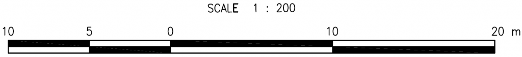
SCALE BAR: Graphic ruler that measures distances from drawing to real world
STREET: Public road adjacent to property, accessible by vehicles and pedestrians

STREET: Public road adjacent to property, accessible by vehicles and pedestrians
LOT AND PLAN NUMBERS: Identifies the land, record, registration of the property

TOPOGRAPHIC BOUNDARY SURVEY: Defines the outer limits of an area’s surface features
POWER POLE: Vertical structure supporting the overhead power lines and various utilities

POWER POLE: Vertical structure supporting the overhead power lines and various utilities
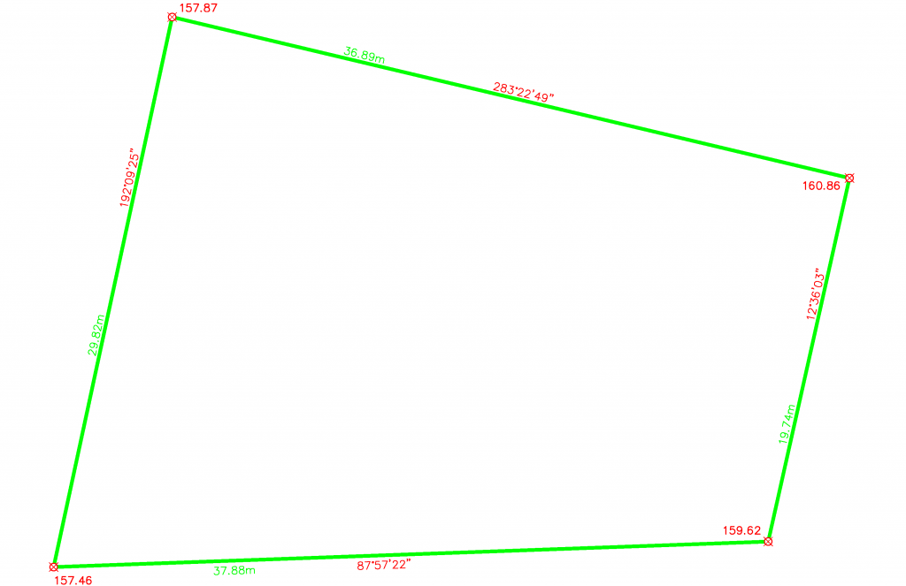
SPOT ELEVATION: Precise level of a point measured from the property corner

SPOT ELEVATION: Precise level of a point measured from the property corner
SPOT ELEVATION: Precise level of a point measured from the property corner
SPOT ELEVATION: Precise level of a point measured from the property corner
RETAINING WALL: Structure designed to restrain soil of the slope
FENCE: An outdoor vertical barrier defining property boundary

EXISTING SHED: Roofed and walled structure
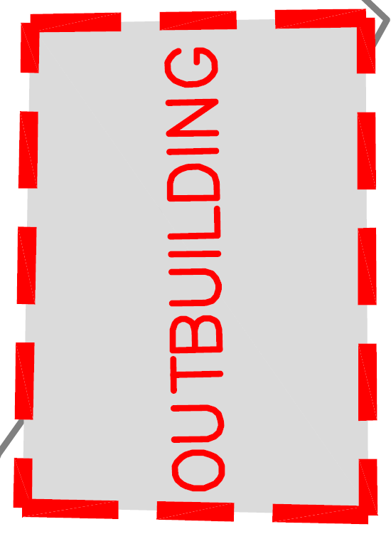
EXISTING SHED: Roofed and walled structure
DIMENSION: The length/measurement of the property line
DIMENSION: The length/measurement of the property line
DIMENSION: The length/measurement of the property line
DIMENSION: The length/measurement of the property line
BEARING: Describes the direction of the measured property line
BEARING: Describes the direction of the measured property line
BEARING: Describes the direction of the measured property line
BEARING: Describes the direction of the measured property line
ROAD EDGE: Indicating slope beyond this line
MAJOR CONTOUR: Shows major ground elevation changes every 1.25m
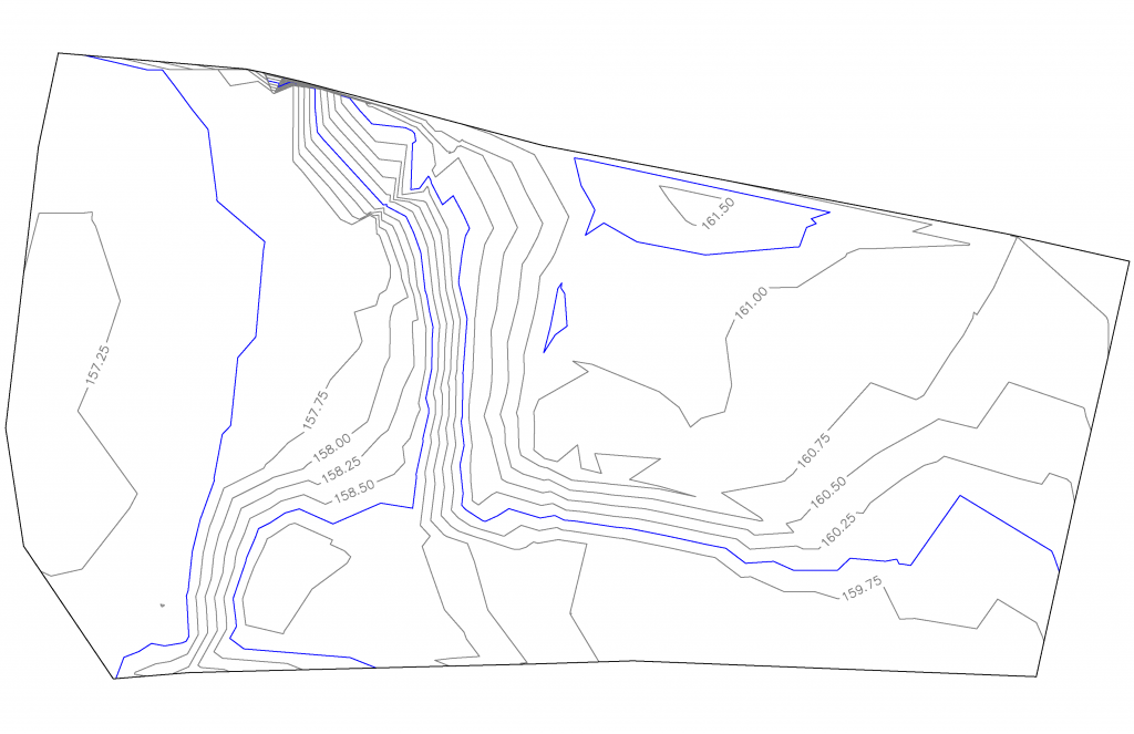
MAJOR CONTOUR: Shows major ground elevation changes every 1.25m
MAJOR CONTOUR: Shows major ground elevation changes every 1.25m
MAJOR CONTOUR: Shows major ground elevation changes every 1.25m
MAJOR CONTOUR: Shows major ground elevation changes every 1.25m
MINOR CONTOUR: Shows minor ground elevation changes every 0.25m
MINOR CONTOUR: Shows minor ground elevation changes every 0.25m
MINOR CONTOUR: Shows minor ground elevation changes every 0.25m
MINOR CONTOUR: Shows minor ground elevation changes every 0.25m
MINOR CONTOUR: Shows minor ground elevation changes every 0.25m
MINOR CONTOUR: Shows minor ground elevation changes every 0.25m
MINOR CONTOUR: Shows minor ground elevation changes every 0.25m
MINOR CONTOUR: Shows minor ground elevation changes every 0.25m
MINOR CONTOUR: Shows minor ground elevation changes every 0.25m
MINOR CONTOUR: Shows minor ground elevation changes every 0.25m
MINOR CONTOUR: Shows minor ground elevation changes every 0.25m
MINOR CONTOUR: Shows minor ground elevation changes every 0.25m
MINOR CONTOUR: Shows minor ground elevation changes every 0.25m
MINOR CONTOUR: Shows minor ground elevation changes every 0.25m
MINOR CONTOUR: Shows minor ground elevation changes every 0.25m
MINOR CONTOUR: Shows minor ground elevation changes every 0.25m
MAJOR TREES: Remarkable rooted tall plant with trunk, branches and leaves
MAJOR TREES: Remarkable rooted tall plant with trunk, branches and leaves
MAJOR TREES: Remarkable rooted tall plant with trunk, branches and leaves
MAJOR TREES: Remarkable rooted tall plant with trunk, branches and leaves

MAJOR TREES: Remarkable rooted tall plant with trunk, branches and leaves
MAJOR TREES: Remarkable rooted tall plant with trunk, branches and leaves
MAJOR TREES: Remarkable rooted tall plant with trunk, branches and leaves
MAJOR TREES: Remarkable rooted tall plant with trunk, branches and leaves
MAJOR TREES: Remarkable rooted tall plant with trunk, branches and leaves
MAJOR TREES: Remarkable rooted tall plant with trunk, branches and leaves
MAJOR TREES: Remarkable rooted tall plant with trunk, branches and leaves
MAJOR TREES: Remarkable rooted tall plant with trunk, branches and leaves
MAJOR TREES: Remarkable rooted tall plant with trunk, branches and leaves
MAJOR TREES: Remarkable rooted tall plant with trunk, branches and leaves
MAJOR TREES: Remarkable rooted tall plant with trunk, branches and leaves
MAJOR TREES: Remarkable rooted tall plant with trunk, branches and leaves
MAJOR TREES: Remarkable rooted tall plant with trunk, branches and leaves
MAJOR TREES: Remarkable rooted tall plant with trunk, branches and leaves
DRILL TEST HOLE: Subsurface analysis for foundation, exploration, etc.

DRILL TEST HOLE: Subsurface analysis for foundation, exploration, etc.
DRILL TEST HOLE: Subsurface analysis for foundation, exploration, etc.
DRILL TEST HOLE: Subsurface analysis for foundation, exploration, etc.
DRILL TEST HOLE: Subsurface analysis for foundation, exploration, etc.
DRILL TEST HOLE: Subsurface analysis for foundation, exploration, etc.
DRILL TEST HOLE: Subsurface analysis for foundation, exploration, etc.